Survey & Mapping
Read More
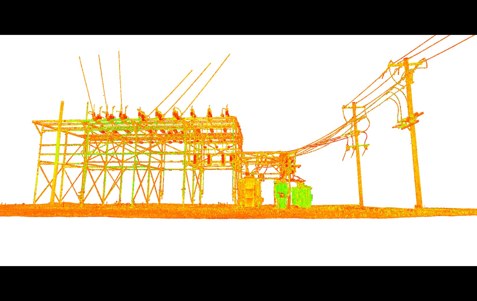
Laser scanning technology is a highly efficient data-collection tool that offers enhanced accuracy, improved worker and public safety benefits, and substantial cost savings for a variety of survey, design, and construction projects. High definition laser scanners (HDS) are used to collect precise three-dimensional object data at the project location. Through precise wide-angle emission and reception of laser light pulses, our HDS units map exact distances to every scene surface at an incredible 50,000 digital data points per second. Three-dimensional integration of this digital data into a “point cloud” creates a powerful visualization tool and source document that are invaluable for modeling, design and reference purposes.

Thomas A. Parker, PLS
Director of Survey & Mapping Services
Office: 315.203.8095
Services
- High Definition 3D Laser Scanning
- Boundary Survey
- Topographic Survey
- Global Positioning Services
- Construction Stakeout Services
- Geographic Information System "GIS"
- Other Surveying Services
High Definition 3D Laser Scanning
- Bridge Surveys
- Structure Deformation Monitoring
- Historic Restoration Facade Surveys
- As-Built Surveys of Complex Facilities
- As-Built Surveys of Existing Buildings
- As-Built Surveys of Steelworks, Columns and Structures
- Forensic Surveys of Accident/Crime Scenes
- Limited Access Site Surveys
Boundary Survey
- ALTA/ACSM Land Title Surveys
- Residential Surveys
- Commercial Surveys
- Mortgage Surveys
- Easement Surveys
- Property Descriptions
- Subdivision Planning and Mapping
- Right-of-Way Mapping
Topographic Survey
- Detailed Topographic Services
- Digital Terrain Modeling
Global Positioning Services
- GPS Control Network Services
- Base Station Data Collection Services
- Real-Time Kinematics GPS Services
Construction Stakeout Services
- Construction Layout Services
- Property Line Stakeout
- Subdivision Monumentation Services
Geographic Information System "GIS"
- Create interactive maps to display all types of information.
- Create dashboards to display the analyzed data alongside the map
- Create custom GIS surveys to gather data
Other Surveying Services
- FEMA Elevation Certificates
- FEMA LOMA Applications
- Slope Analysis Services
- Tree Surveys
- Volumetric Surveys
- Wetland Mapping
- Deformation Monitoring
- Constraints Mapping
- Gas Well Permits and Mapping
Featured
Projects

Industry Partners


Client Partners