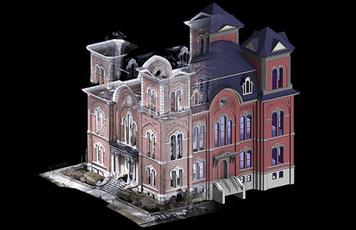
“Point Cloud” Modeling
Laser scanner “point clouds” are invaluable data sets that we use to establish existing conditions and to build a Revit 3-D model. This digital data capture to model development workflow greatly speeds our ability to establish a project baseline that offers significant advantages:
- Creates a complete existing conditions record for modeling tasks
- Interior scans useful for calculating precise volumes and for modeling MEP systems
- Safety advantages for field personnel through remote data capture
- Historic and hard-to-access façade and building features can be measured precisely
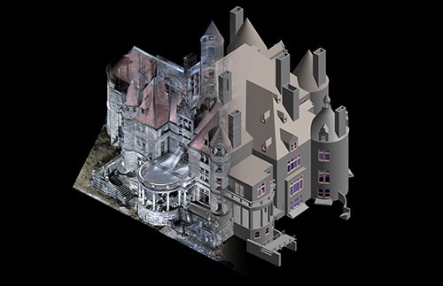
John Dewey Academy Laser Scanning and Modeling